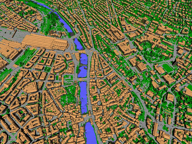
Futurity: Tourist pics and YouTube create 3D model of city
Tourist pics and YouTube create 3D model of city – Futurity
A new technology platform uses algorithms to create 3D city models from image and video data. The platform, known as “VarCity”, is so versatile that it can use, evaluate, and automatically combine all possible kinds of image sources: aerial photographs, 360-degree panoramic images taken with special vehicles, and even standard photos such as those published by tourists on social networks and online.
Related Articles
-
Futurity: Tourist pics and YouTube create 3D model of city
-
BBC: Cities need ‘hedges as well as trees’ for environment
-
Forget Flying Cars: Passenger Drones May Be Hovering Soon at a Location Near You
-
Fast Co.Design: The Quest To Grow Cities From Scratch
-
CNET: When a smart apartment meets a smart city…
Share this:
- Click to share on LinkedIn (Opens in new window)
- Click to share on Facebook (Opens in new window)
- Click to share on Pocket (Opens in new window)
- Click to share on Tumblr (Opens in new window)
- Click to share on Reddit (Opens in new window)
- Click to share on WhatsApp (Opens in new window)
- Click to print (Opens in new window)
- Click to email a link to a friend (Opens in new window)

