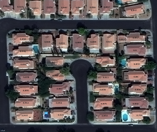
Deep learning enables automated extraction of building footprints and road networks from satellite imagery
Deep learning enables automated extraction of building footprints and road networks from satellite imagery
Automated feature extraction from satellite imagery has made major progress in the last year. Accurate building footprints extracted from high resolution satellite imagery are available from companies such as Ecopia (which has just announced a partnership with DigitalGlobe). Also NVIDIA…
[siteorigin_widget class=”Recent_Posts_Widget_Extended”][/siteorigin_widget]
Share this:
- Click to share on LinkedIn (Opens in new window)
- Click to share on Facebook (Opens in new window)
- Click to share on Pocket (Opens in new window)
- Click to share on Tumblr (Opens in new window)
- Click to share on Reddit (Opens in new window)
- Click to share on WhatsApp (Opens in new window)
- Click to print (Opens in new window)
- Click to email a link to a friend (Opens in new window)

